REAL SURVEYORS.
REAL WORK.
REALLY GOOD DATA.

Surveying takes place in the field, where boots get muddy, boundaries are measured, and boundaries are pushed. See how real surveyors collect data and turn it into real deliverables, despite challenging conditions, rugged terrain and lurking danger.

Computer Monitor with Pointcloud data

SEASON 1 OF DOWN TO EARTH 

Watch Now

WATCH DOWN TO EARTH AND SEE
THE RESULTS FOR YOURSELF

Surveying takes place in the field, where boots get muddy, boundaries are measured, and boundaries are pushed. See how real surveyors collect data and turn it into real deliverables, despite challenging conditions, rugged terrain and lurking danger.

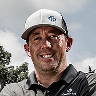
Jeff Davis

Survey Coordinator/UAV Pilot, Crafton Tull

We knew that terrain was going to be an issue on this one, so we had to really make sure that our terrain follow was working correctly. The terrain follow quad uses a surface model or terrain model to follow existing terrain. So, we were really able to monitor it and make sure it was doing what it was supposed to be doing.”
Nick Tucker P.S.

Vice President, Energy Services

Typically with a project like this, we would deploy one to two crews, and they would go out and shoot GPS break lines on the roads on the tops and a project of this magnitude would probably take somewhere in the neighborhood of two weeks. With the Microdrones mdLiDAR1000 we were able to capture the imagery and LiDAR to produce the deliverables in two days field time. We’re saving that time in the field, saving that time in the office, and getting the same set of deliverables plus imagery and things of that nature that you wouldn’t normally be able to capture.”